15 Incredible Cloud Formations
The skies have always been a constant source of fascination for humans. One common
mass that everyone on the planet has seen in one form or another are clouds. They can come in all sizes, shapes, and colours; and their distinct formations have been studied by meteorologists for centuries. Below you will find a collection of 15 fascinating and incredible cloud formations.
1. Lenticular Clouds
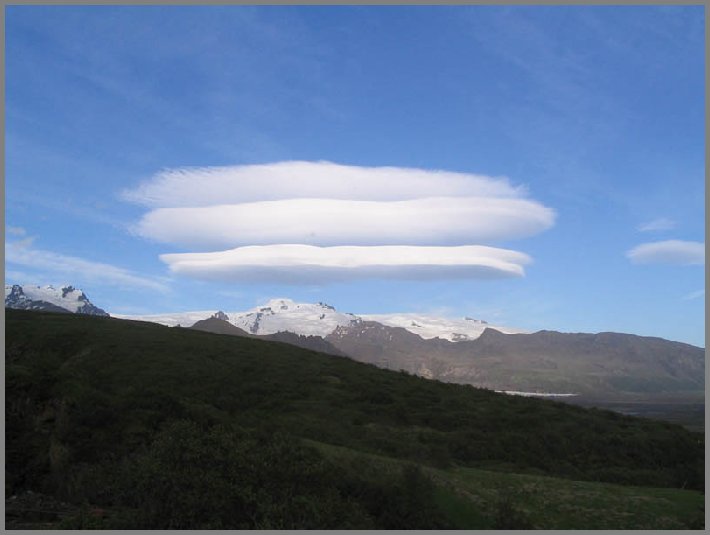
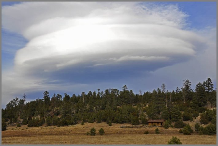
Lenticular clouds (Altocumulus lenticularis) are stationary lens-shaped clouds that form at high altitudes, normally aligned perpendicular to the wind direction. Lenticular clouds can be separated into altocumulus standing lenticularis (ACSL), stratocumulus standing lenticular (SCSL), and cirrocumulus standing lenticular (CCSL). Due to their shape, they have been offered as an explanation for some Unidentified Flying Object (UFO) sightings.
2. Undulatus asperatus
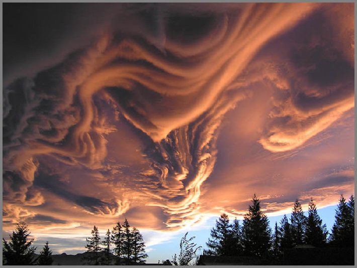
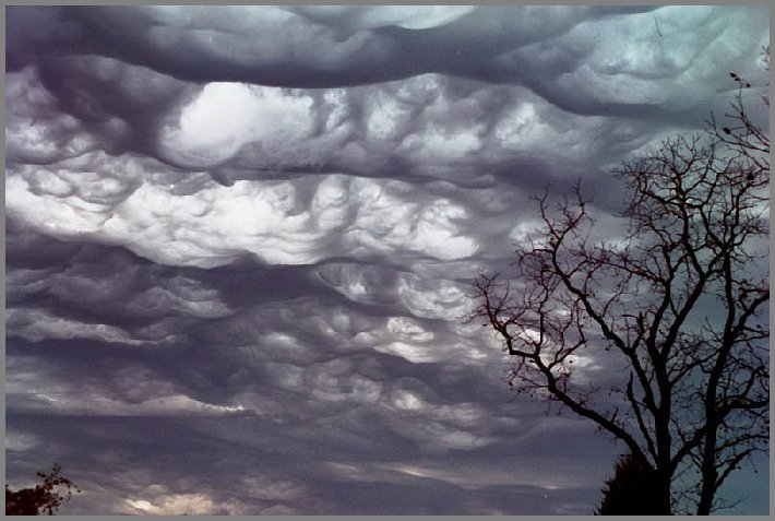
The name translates approximately as roughened or agitated waves.
3. Noctilucent (night) clouds
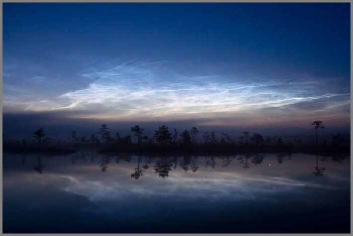
Night clouds or noctilucent clouds are tenuous cloud-like phenomena that are the “ragged-edge” of a much brighter and pervasive polar cloud layer called polar mesospheric clouds in the upper atmosphere, visible in a deep twilight. They are made of crystals of water ice. The name means roughly night shining in Latin.
4. Fallstreak Hole or Hole Punch Cloud
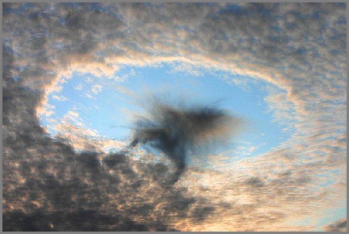
A fallstreak hole, also known as a hole punch cloud, punch hole cloud, canal cloud or cloud hole, is a large circular gap that can appear in cirrocumulus or altocumulus clouds. Such holes are formed when the water temperature in the clouds is below freezing but the water has not frozen yet due to the lack of ice nucleation particles.
5. Mammatus clouds
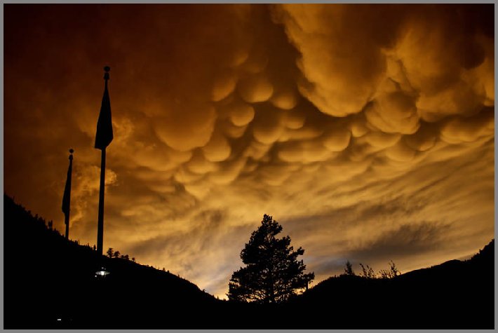
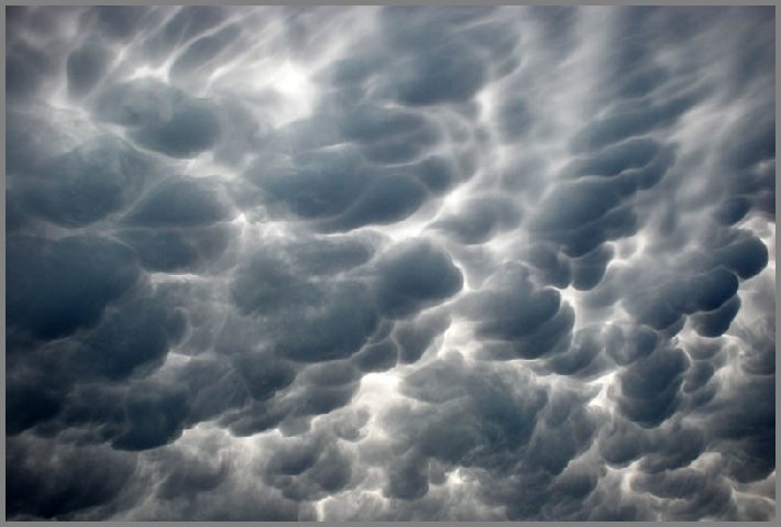
Mammatus, also known as mammatocumulus (meaning “mammary cloud” or “breast cloud”), is a meteorological term applied to a cellular pattern of pouches hanging underneath the base of a cloud.
6. Wave Clouds
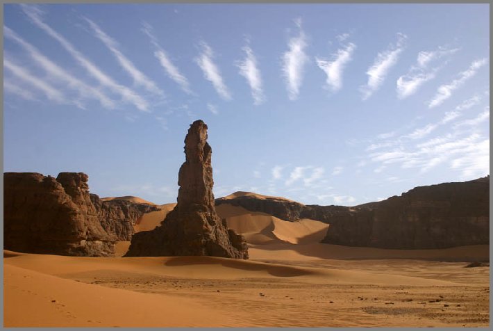
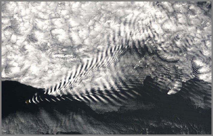
A wave cloud is a cloud form created by atmospheric internal waves. The atmospheric internal waves that form wave clouds are created as stable air flows over a raised land feature such as a mountain range, and can form either directly above or in the lee of the feature.
7. Cloud iridescence
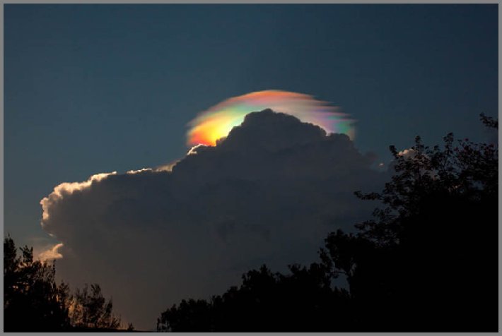
Cloud iridescence is the occurrence of colors in a cloud similar to those seen in oil films on puddles, and is similar to irisation. It is a fairly uncommon phenomenon, most often observed in altocumulus, cirrocumulus and lenticular clouds, and very rarely in Cirrus clouds. The colors are usually pastel, but can be very vivid.
8. Roll clouds
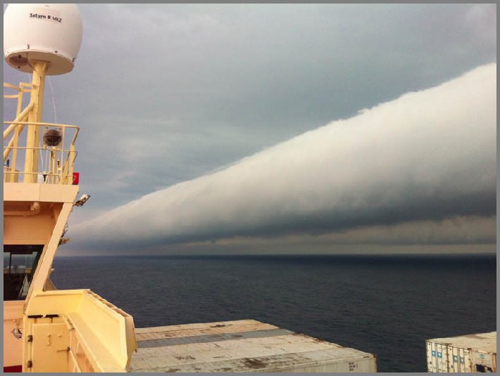
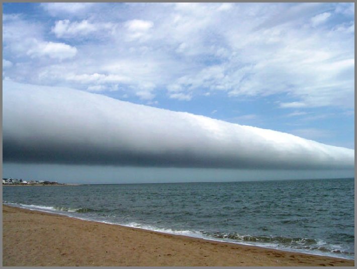
A roll cloud is a low, horizontal, tube-shaped, and relatively rare type of arcus cloud. They differ from shelf clouds by being completely detached from other cloud features. Roll clouds usually appear to be “rolling” about a horizontal axis. They are a solitary wave called a soliton, which is a wave that has a single crest and moves without changing speed or shape.
9. Shelf clouds
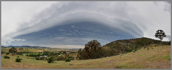

A shelf cloud is a low, horizontal, wedge-shaped arcus cloud. A shelf cloud is attached to the base of the parent cloud, which is usually a thunderstorm. Rising cloud motion often can be seen in the leading (outer) part of the shelf cloud, while the underside often appears turbulent and wind-torn. Cool, sinking air from a storm cloud’s downdraft spreads out across the land surface, with the leading edge called a gust front. This outflow cuts under warm air being drawn into the storm’s updraft. As the lower cooler air lifts the warm moist air, its water condenses, creating a cloud which often rolls with the different winds above and below (wind shear).
10. Pyrocumulus cloud
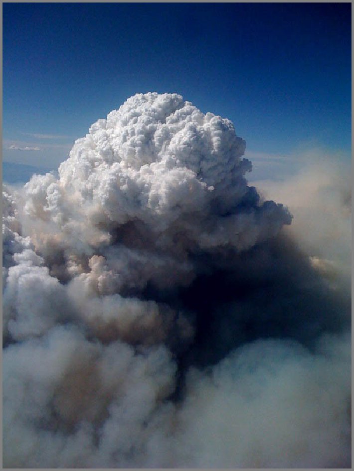
A pyrocumulus, or fire cloud, is a dense cumuliform cloud associated with fire or volcanic activity.
11. Wave windows
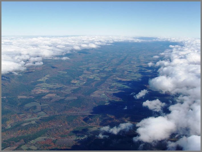
In meteorology, lee waves are atmospheric standing waves. Both lee waves and the rotor may be indicated by specific wave cloud formations if there is sufficient moisture in the atmosphere, and sufficient vertical displacement to cool the air to the dew point. Waves may also form in dry air without cloud markers. Wave clouds do not move downwind as clouds usually do, but remain fixed in position relative to the obstruction that forms them.
12. Actinoform clouds
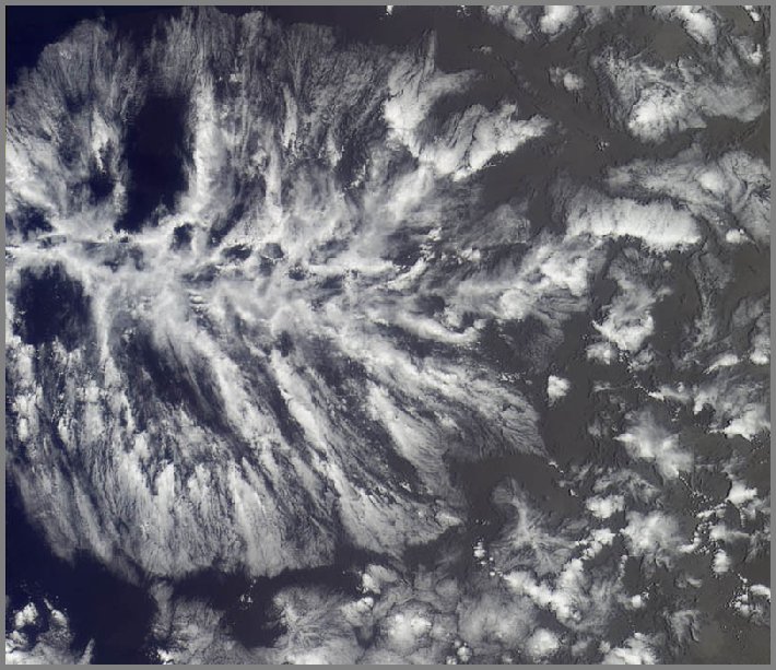
An actinoform or actiniform cloud is a collection of marine low clouds that takes a distinct shape. They are named after the Greek word for “ray” due to their radial structure. Actinoform clouds can spread out over 190 miles across and thus cannot be easily seen with the naked eye. In addition, actinoform clouds can form “trains” that are up to six times the length of the original cloud field, yet they maintain their own, distinct identity.
13. Polar stratospheric (nacerous) clouds
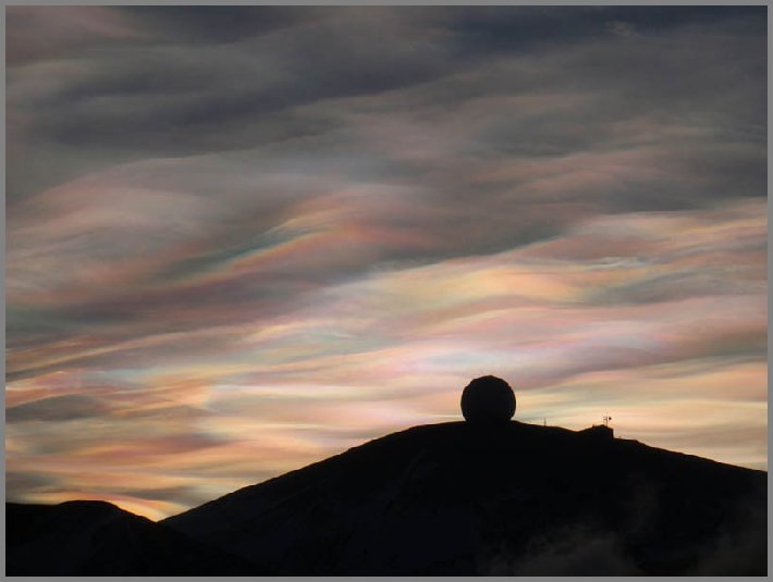
Polar stratospheric clouds or PSCs, also known as nacreous clouds, are clouds in the winter polar stratosphere at altitudes of 49,000 – 82,000 feet.
14. Pileus (scarf/cap) clouds
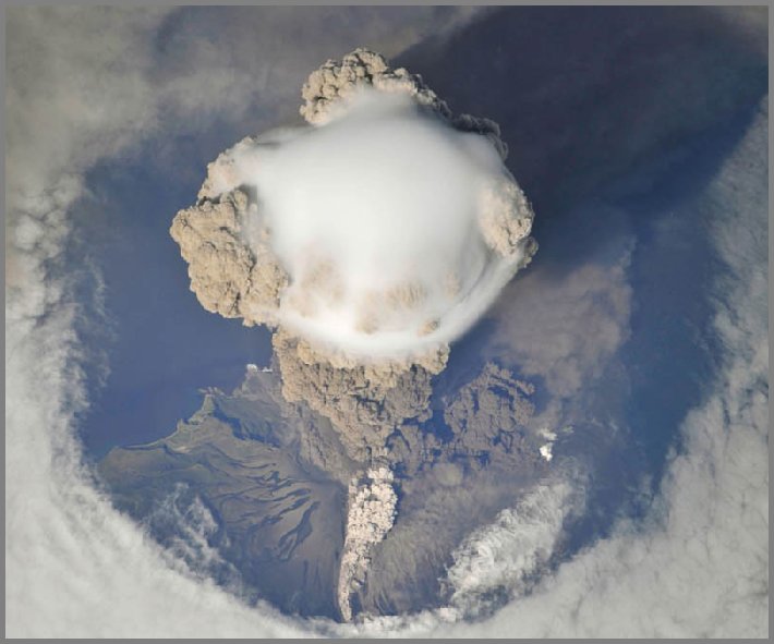
A pileus, also called scarf cloud or cap cloud, is a small, horizontal, altostratus cloud that can appear above a cumulus or cumulonimbus cloud, giving the parent cloud a characteristic “hoodlike” appearance. They are formed by strong updrafts acting upon moist air at lower altitudes, causing the air to cool to its dew point. As such, they are usually indicators of severe weather, and a pileus found atop a cumulus cloud often foreshadows transformation into a cumulonimbus cloud, as it indicates a strong updraft within the cloud.
15. Morning Glory Clouds
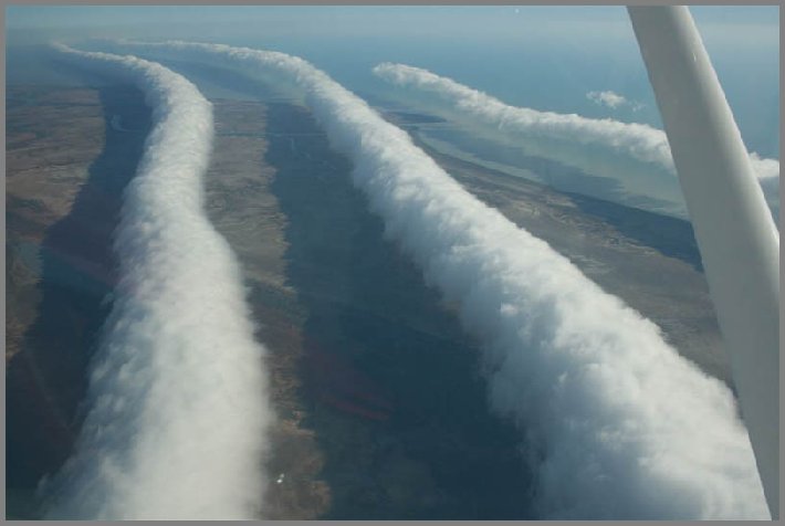
The Morning Glory cloud is a rare meteorological phenomenon occasionally observed in different locations around the world. The southern part of Northern Australia’s Gulf of Carpentaria is the only known location where it can be predicted and observed on a more or less regular basis. The settlement of Burketown attracts glider pilots intent on riding this phenomenon.